
Blog
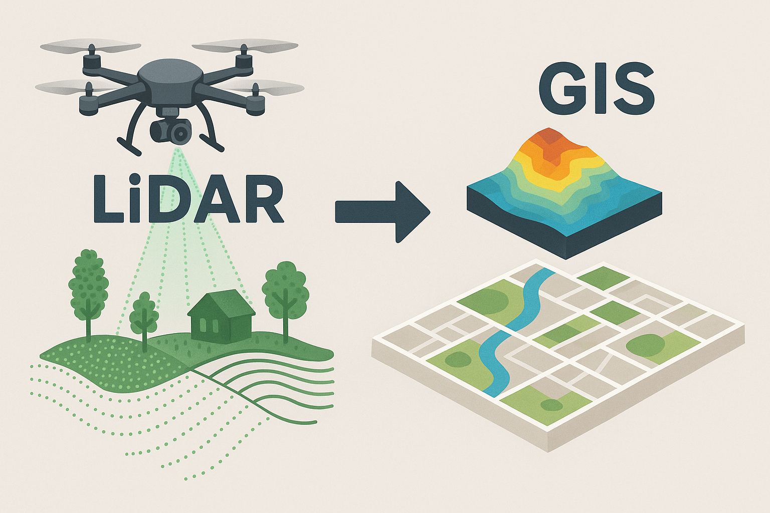
- The 3D structure of vegetation and terrain in Europe is now almost completely mapped by airborne laser scanning
 Author: Vítězslav Moudrý Understanding the three-dimensional structure of vegetation and terrain is fundamental for explaining… Více informací: The 3D structure of vegetation and terrain in Europe is now almost completely mapped by airborne laser scanning
 - FathomDEM raises the bar for the accuracy of global 30 m DEMs to new heights
 Author: Petr Bašta Digital elevation models (DEMs) constitute fundamental data for various governmental, scientific, and… Více informací: FathomDEM raises the bar for the accuracy of global 30 m DEMs to new heights
 - Europe Is Almost Fully Mapped in 3D Using Airborne Laser Scanning
 Author: Vítězslav Moudrý Mapping the three-dimensional structure of vegetation (and terrain) is essential for understanding… Více informací: Europe Is Almost Fully Mapped in 3D Using Airborne Laser Scanning
 - Improving Canopy Height Models in Temperate Regions: The Key to Accurate Forest Monitoring
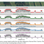
 Author: Vojtěch Barták Canopy height is one of the most important characteristics of forest structure.… Více informací: Improving Canopy Height Models in Temperate Regions: The Key to Accurate Forest Monitoring
 - How to Cool Down Urban Heat
 Author: David Moravec Cities are getting hotter. As concrete, asphalt, and dense apartment blocks increasingly… Více informací: How to Cool Down Urban Heat
 - Invited Lecture by Research Professor Eija Honkavaara: Towards Autonomous Use of Drone Technology for Forestry Applications
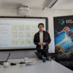
 Author: Jan Komárek As part of the ongoing seminar series on environmental monitoring and geospatial… Více informací: Invited Lecture by Research Professor Eija Honkavaara: Towards Autonomous Use of Drone Technology for Forestry Applications
 - Novel Method for Correcting Observer-Specific Bias in Species Distribution Models
 Author: Petr Balej The prediction accuracy of Species Distribution Models (SDMs) is often compromised by… Více informací: Novel Method for Correcting Observer-Specific Bias in Species Distribution Models
 - “Cultivated lands: blind spots in global biodiversity data,”
 A new article published in Trends in Ecology & Evolution draws attention to a surprising… Více informací: “Cultivated lands: blind spots in global biodiversity data,”
 - Mammal Monitoring and Forest Damage Modelling in Agricultural Landscapes, Guest Lecture
 Author: Jan Komárek During the final EarthBridge project meeting, Stephanie Roilo from the University of… Více informací: Mammal Monitoring and Forest Damage Modelling in Agricultural Landscapes, Guest Lecture
 - Towards 90 m Resolution Digital Terrain Models from Spaceborne Lidar: Balancing Accuracy and Sampling Intensity
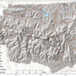
 Author: Petra Pracná Mapping the Earth’s terrain beneath forests and across rugged mountains has always… Více informací: Towards 90 m Resolution Digital Terrain Models from Spaceborne Lidar: Balancing Accuracy and Sampling Intensity
 - Mining palimpsest: Distinguishing between prehistoric and modern mining using remote sensing methods, field survey and MaxEnt
 Author: Jan Fišer The history of the use of certain raw materials goes back thousands… Více informací: Mining palimpsest: Distinguishing between prehistoric and modern mining using remote sensing methods, field survey and MaxEnt
 - Vítězslav Moudrý from the EarthBridge team co-authored a new article in Forest Ecology and Management
 Authors: Vítězslav Moudrý, Xiao Liu, Bernhard Schuldt, Matthias Forkel Our colleague Vítězslav Moudrý from the… Více informací: Vítězslav Moudrý from the EarthBridge team co-authored a new article in Forest Ecology and Management
 - Flying Higher for Forest Insights: Accuracy and Limits of Drone-Based Tree Height Estimation
 Author: Komárek J., Rous J., Klouček T. (2025). The bigger, the better? Sample size effects… Více informací: Flying Higher for Forest Insights: Accuracy and Limits of Drone-Based Tree Height Estimation
 - Restoration from Above: AI-Generated Audio Inspired by the Article of Lucie Moudrá
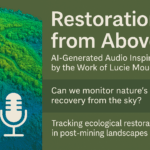 Can we monitor nature’s recovery from the sky? This short AI-generated audio interview explores the… Více informací: Restoration from Above: AI-Generated Audio Inspired by the Article of Lucie Moudrá
 - Restoration of post-mining landscapes from above
 Author: Lucie Moudrá As coal mining sites across Europe are gradually retired, a unique opportunity… Více informací: Restoration of post-mining landscapes from above
 - Monitoring vegetation recovery on post-mining sites using multitemporal LiDAR Data
 Author: Zuzana Zmeškalová Across Europe, landscapes once dominated by coal mining are undergoing rapid ecological… Více informací: Monitoring vegetation recovery on post-mining sites using multitemporal LiDAR Data
 - ESA Living Planet Symposium 2025 in Vienna
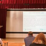
 Auhor: Jiří Rous In late June, I travelled to Vienna to attend the ESA Living… Více informací: ESA Living Planet Symposium 2025 in Vienna
 - Is TanDEM-X a DTM or DSM?
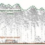 Author: Kateřina Gdulová Global radar-based Digital Elevation Models (DEMs), such as TanDEM-X and SRTM, are… Více informací: Is TanDEM-X a DTM or DSM?
 - „The time of acquisition of multispectral predictors matters: the role of seasonality in bird species distribution models“
 Dominika Prajzlerová has published a new article in Ecography titled:„The time of acquisition of multispectral… Více informací: „The time of acquisition of multispectral predictors matters: the role of seasonality in bird species distribution models“
 - Darkness as an Endangered Species: Why Light Pollution Matters
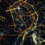 Author: Tomáš Klouček Darkness, once an integral part of life on Earth, is now rapidly… Více informací: Darkness as an Endangered Species: Why Light Pollution Matters
 - Early Research Mobility Experiences: My Visit Exchange to Bonn
 Author: Michal Kučera To make the most of my PhD journey, I sought early experience… Více informací: Early Research Mobility Experiences: My Visit Exchange to Bonn
 - EARSeL 2025 Symposium in Prague
 Author: Jiří Rous At the end of May, I had the opportunity to attend the… Více informací: EARSeL 2025 Symposium in Prague
 - Why Timing Matters: How seasonal changes shape bird species distribution models
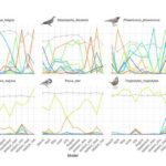 Author: Dominika Prajzlerová Species Distribution Models (SDMs) are powerful tools that help scientists understand where… Více informací: Why Timing Matters: How seasonal changes shape bird species distribution models
 - Tracking the Hidden Climate Impact of Invasive Plants
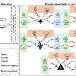 Author: Giorgi Kozhoridze A joint research initiative between the Czech University of Life Sciences in… Více informací: Tracking the Hidden Climate Impact of Invasive Plants
 - How Ground-Based LiDAR Is Transforming Forest Inventories
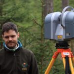 Author: Juan Alberto Molina Valero These days, with drones and satellites capturing stunning views from… Více informací: How Ground-Based LiDAR Is Transforming Forest Inventories
 - Lidar in Students‘ Final Theses
 Author: Vitezslav Moudry Recent months have been marked by the completion and evaluation of student… Více informací: Lidar in Students‘ Final Theses
 - When Wind Blows
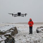
 Author: Jan Komárek Drones have revolutionised environmental monitoring, promising on-demand, high-resolution data collection in places… Více informací: When Wind Blows
 - Experience from the Polar Winter School – Remote Sensing in Arctic Conditions
 Author: Jan Komárek From March 2nd to 8th, 2025, we had the opportunity to participate… Více informací: Experience from the Polar Winter School – Remote Sensing in Arctic Conditions
 - Spectral Characterization of Bird Habitats: Research Exchange at the University of Bonn
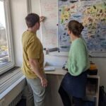 Author: Richard Bittman As part of the „Building Bridges between Earth Observation and Environmental Sciences“… Více informací: Spectral Characterization of Bird Habitats: Research Exchange at the University of Bonn
 - GISOstrava 2025: Revisiting Familiar Places and Exploring the Future of ALS Data
 I can hardly remember the last time I attended the GISOstrava conference. It must have… Více informací: GISOstrava 2025: Revisiting Familiar Places and Exploring the Future of ALS Data
 - Spectral diversity beyond the Spectral Variation Hypothesis: what comes next?
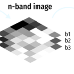 Author: Michela Perrone Nearly three decades ago, the Spectral Variation Hypothesis (SVH) proposed a tremendously… Více informací: Spectral diversity beyond the Spectral Variation Hypothesis: what comes next?
 - We are building corner reflectors!
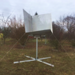 How Can a Satellite Detect Movement on Earth? Author: David Moravec Electromagnetic radiation behaves like… Více informací: We are building corner reflectors!
 - “EarthBridge goes to BioSpace25”: Exploring the Future of Biodiversity Research with EO
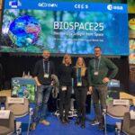 Authors: Michela Perrone, Dominika Prajzlerová, David Moravec, Vojtěch Barták The BioSpace25 conference just ended, and… Více informací: “EarthBridge goes to BioSpace25”: Exploring the Future of Biodiversity Research with EO
 - Stream Network Delineation: Beyond the Vertical Accuracy of global DEMs
 Authors: Vítězslav Moudrý, Jana Marešová, Petr Bašta I am sure you are aware of my… Více informací: Stream Network Delineation: Beyond the Vertical Accuracy of global DEMs
 - Can We Trust Predicted Global Canopy Height Maps?
 Author: Vitezslav Moudry Global mapping of forest height is an extremely important task. However, measuring… Více informací: Can We Trust Predicted Global Canopy Height Maps?
 - EarthBridge Scientists Featured in GEO BON Newsletter
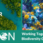 In the December edition of the GEO BON newsletter, which highlights global efforts in biodiversity… Více informací: EarthBridge Scientists Featured in GEO BON Newsletter