
Rubrika: News
-
Dominika Prajzlerová at University of Bonn
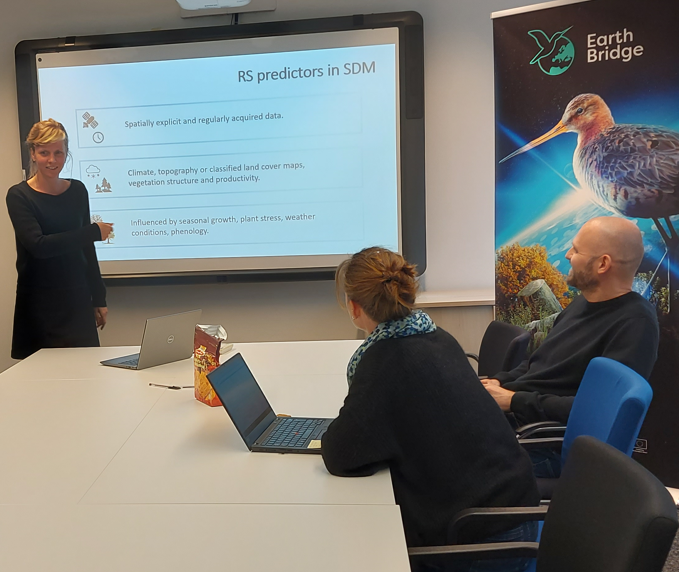
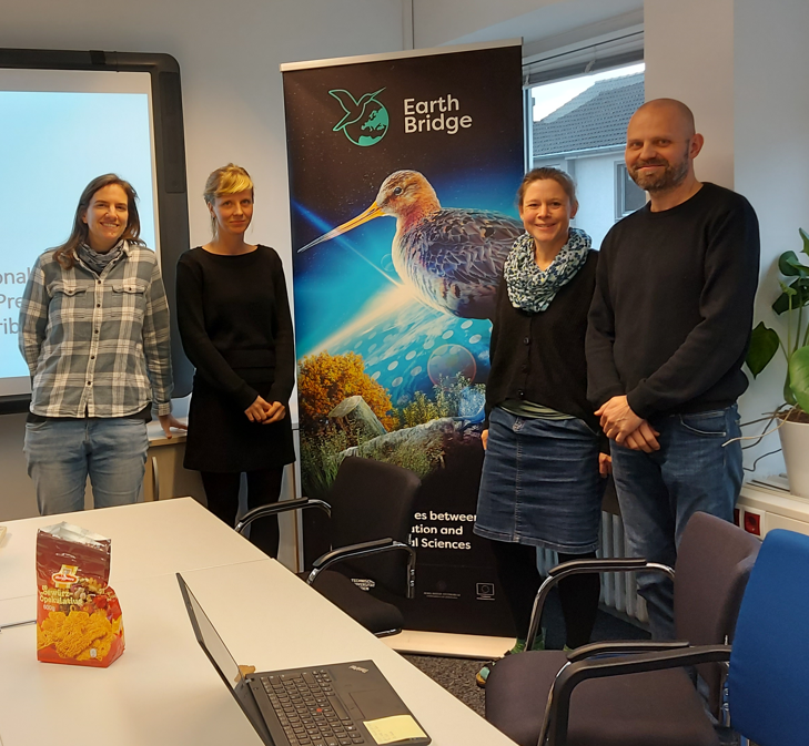
Dominika Prajzlerová from CZU Visited UBO: Research Collaboration and Insights Purpose of the Visit The primary objective of Dominika Prajzlerová’s stay in Bonn (November 2024) was to finalize her manuscript, The Time of Acquisition of Multispectral Predictors Matters: The Role of Seasonality in Bird Species Distribution Models. She was invited by Ruben Remelgado, a member…
-

Apply for Research Associate at University of Bonn
The University of Bonn is an international research university offering a broad range of subjects. With a 200-year history, some 35,000 students, more than 6,000 employees and an outstanding reputation in Germany and abroad, the University of Bonn is one of the leading universities in Germany and has been awarded the status of a University…
-
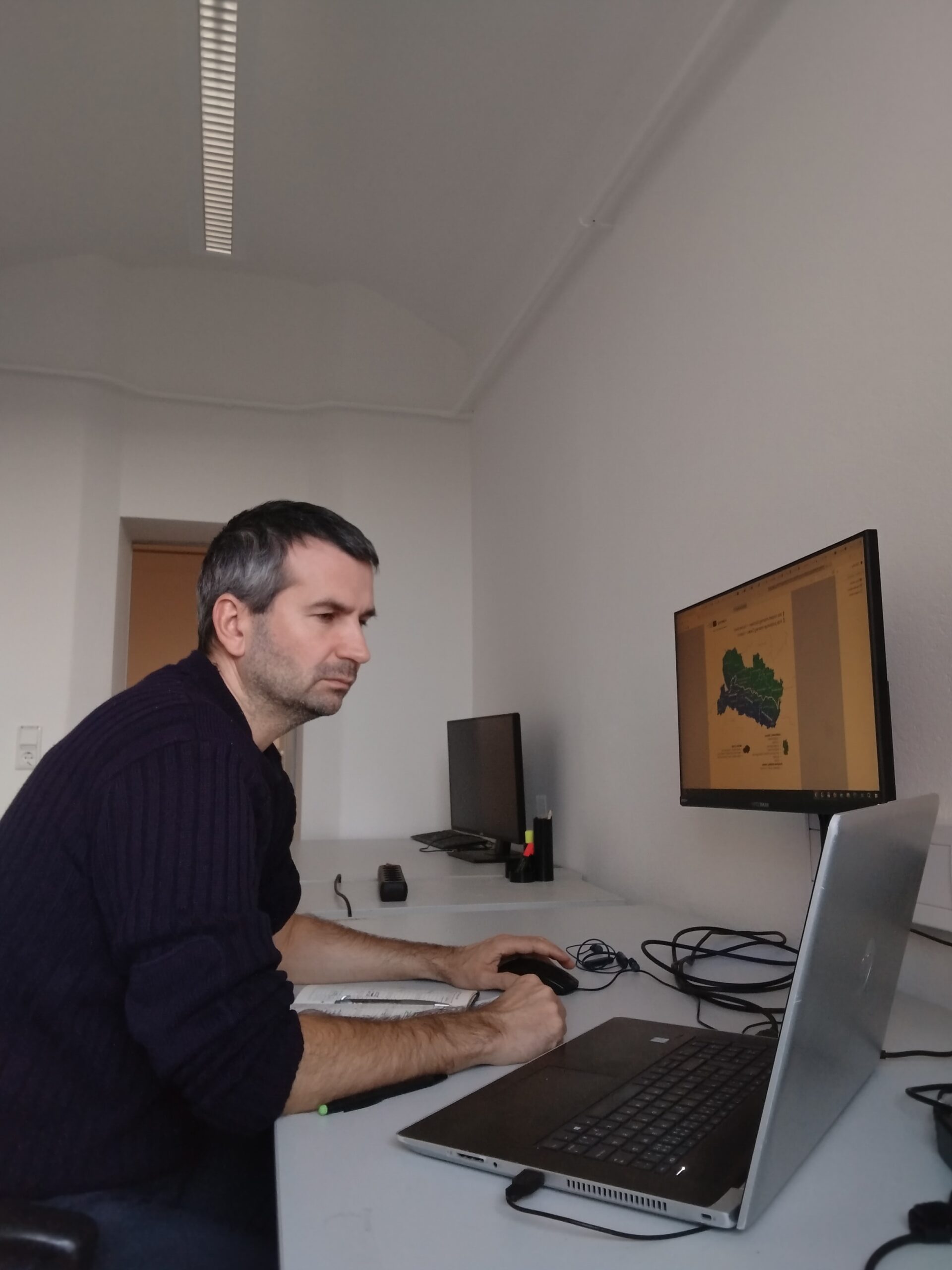
Vojtech Bartak at UBO
Vojtěch Barták from CZU Visited University Bonn: Research Collaboration and Insights Purpose of the Visit The primary goal of Vojtěch Barták’s stay was to advance his research on predicting canopy heights using data from the GEDI satellite altimetry mission and other remote sensing sources. He aimed to discuss his work with colleagues from Anna Cord’s…
-
Successful PhD Defense of Kateřina Gdulová! 🎓
The defended thesis presents innovative research on the vertical accuracy of global digital elevation models (DEMs) with emphasis on the TanDEM-X DEM as the latest addition to the global DEMs. It is based on three scientific papers: Study 1 – TanDEM-X DEM Accuracy: Published in Remote Sensing of Environment—the leading journal in the field—this study…
-
Members of the EarthBridge team collaborated on a new article.
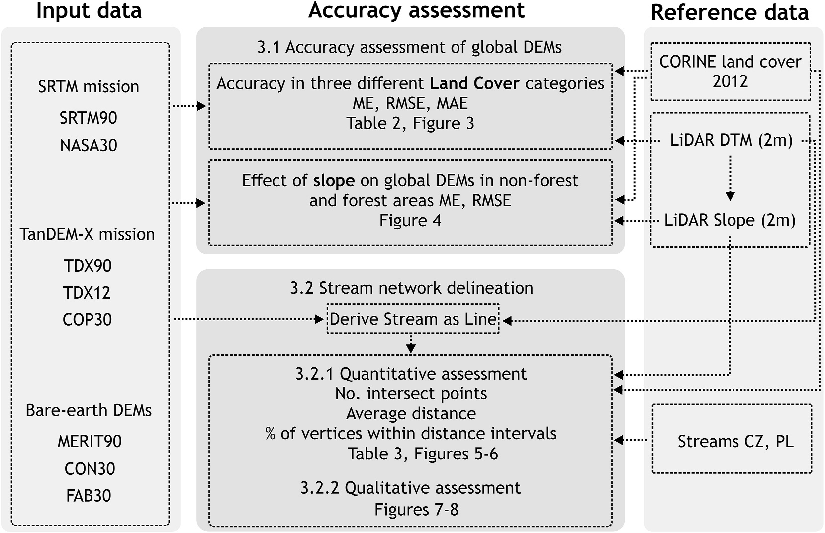
Choosing the Optimal Global Digital Elevation Model forStream Network Delineation: Beyond Vertical Accuracy The Importance of Digital Elevation Models (DEMs)Global digital elevation models (DEMs) are vital for various hydrological applications, including stream network delineation and flood modeling. However, their accuracy often suffers from vegetation and building offsets, making bare-earth DEMs a promising alternative. This study…
-

Jan Komárek from the EarthBridge Team Joins the Evaluation of Biodiversa+ Projects
We are delighted to announce that a member of our team, Jan Komárek, has been selected as an evaluator of project proposals within the prestigious Biodiversa+ program. This program focuses on biodiversity research, and its 4th call, titled „Biodiversity and Transformative Change“ (BiodivTransform), represents an ambitious initiative supporting innovative projects aimed at nature conservation and…
-
Addressing multiple facets of bias and uncertainty in continental scale biodiversity databases
A new article by Elisa Marchetto and her team addresses the growing issue of biases and uncertainties in large-scale biodiversity databases, which are essential for biodiversity research and conservation on a continental scale. Expansion of Biodiversity Databases and Their Limitations The growth of biodiversity databases, such as BIEN and sPlot, presents crucial opportunities for research…
-

Mapping Indicator Species of Segetal Flora
Mapping Indicator Species of Segetal Flora for Result-Based Payments in Arable Land Using UAV Imagery and Deep Learning A recent study published in Ecological Indicators (December 2024) explores an innovative approach to monitoring indicator species of segetal flora in arable fields using UAV imagery and deep learning. The research, conducted by Caterina Barrasso and colleagues,…
-
Vítězslav Moudrý in TUD
Visit of Vítězslav Moudrý from the Faculty of Environmental Sciences, CZU Prague, to TUD Dresden In October 2024, Vítězslav Moudrý from the Faculty of Environmental Sciences at Czech University of Life Sciences Prague (CZU) visited the labs of Matthias Forkel and Anette Eltner at TU Dresden. The purpose of this research exchange was threefold: to…
-
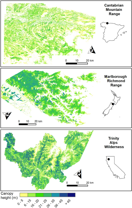
How to Find Accurate Terrain and Canopy Height GEDIFootprints in Temperate Forests and Grasslands?
Research Article by Vítězslav Moudrý. Introduction to GEDI Data Filtering The Global Ecosystem Dynamics Investigation (GEDI) mission collects terrain and canopy height data using spaceborne lidar. While it provides invaluable forest and grassland height metrics, accurately using GEDI data requires filtering out noisy and low-quality observations affected by environmental and acquisition conditions. This study aims…