
Autor: Karolína Hájková
-
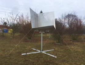
We are building corner reflectors!
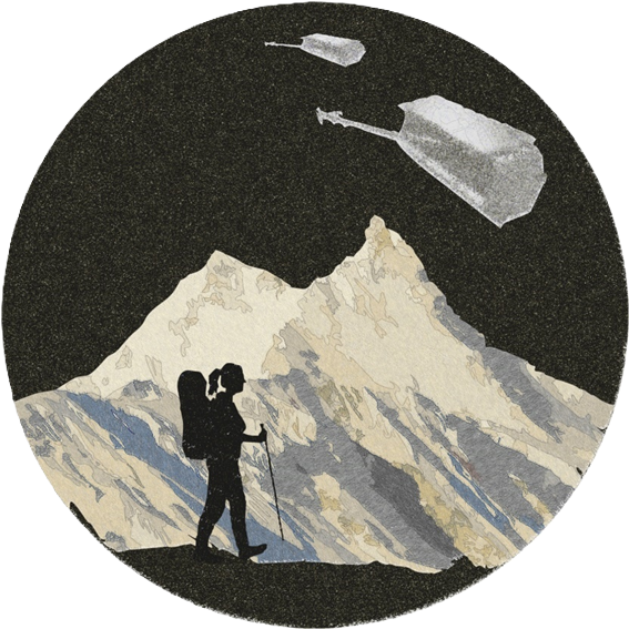
How Can a Satellite Detect Movement on Earth? Author: David Moravec Electromagnetic radiation behaves like a wave. When a satellite equipped with a microwave antenna sends a radar signal toward Earth, it receives a reflected wave in return. But here’s the trick—waves have phases (they oscillate up and down like ocean waves). By measuring the…
-
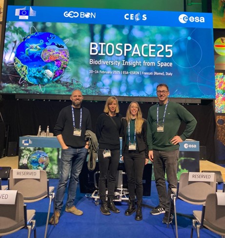
“EarthBridge goes to BioSpace25”: Exploring the Future of Biodiversity Research with EO
Authors: Michela Perrone, Dominika Prajzlerová, David Moravec, Vojtěch Barták The BioSpace25 conference just ended, and it was a blast!Last week, my colleagues (Dominika, David, and Vojta) and I had the incredible opportunity to participate in the BioSpace25 conference hosted by the European Space Agency (ESA) at its Centre for Earth Observation (ESRIN) in Frascati, Italy.…
-
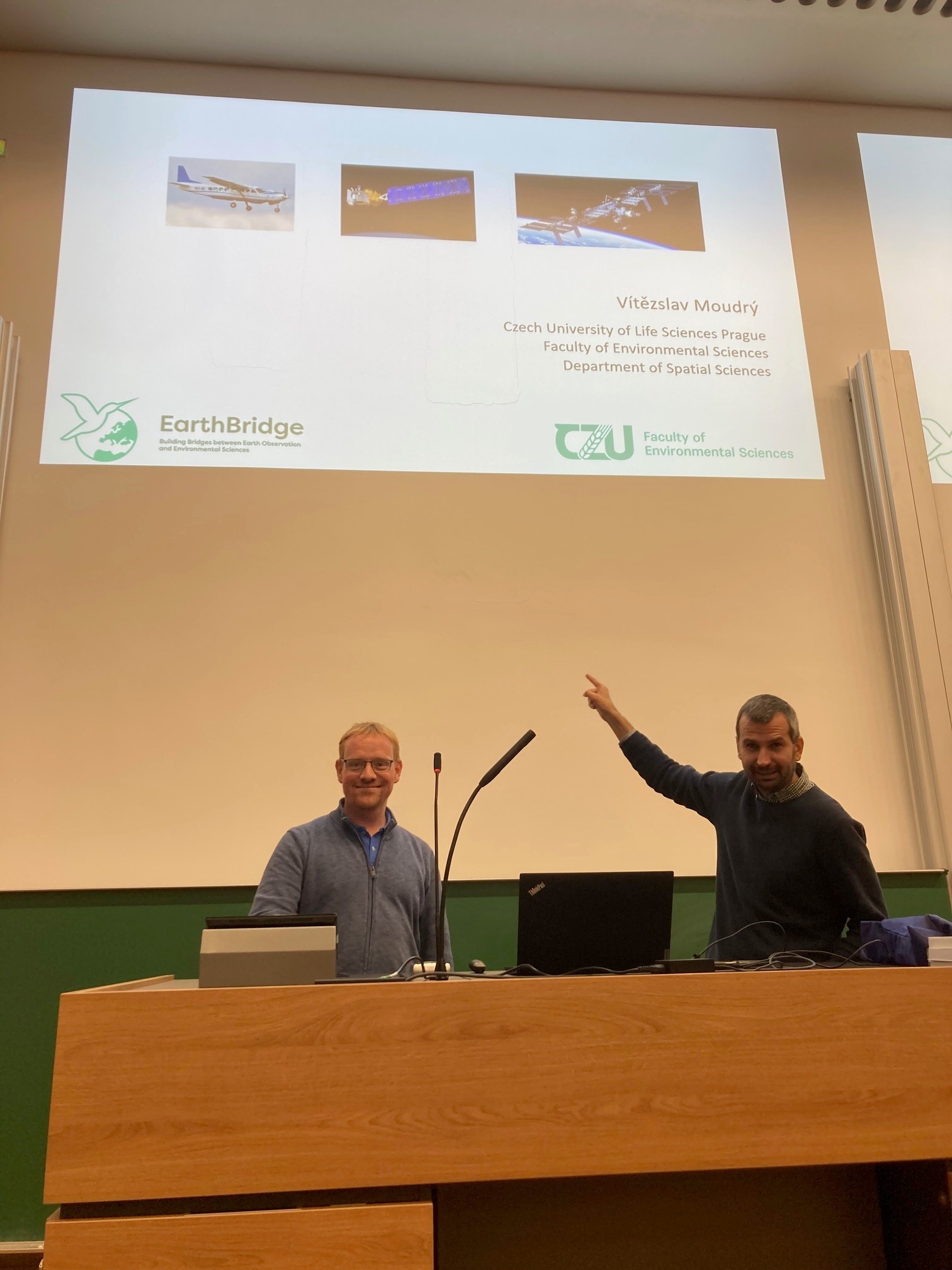
Vítězslav Moudrý in Dresden
I visited TU Dresden twice in the last two weeks. During the first visit, I worked intensively with Xiao Liu on the revision of our paper, which focuses on using GEDI to assess changes in forest vertical structure over time. The opportunity to work and discuss the text together in person was very refreshing compared…
-
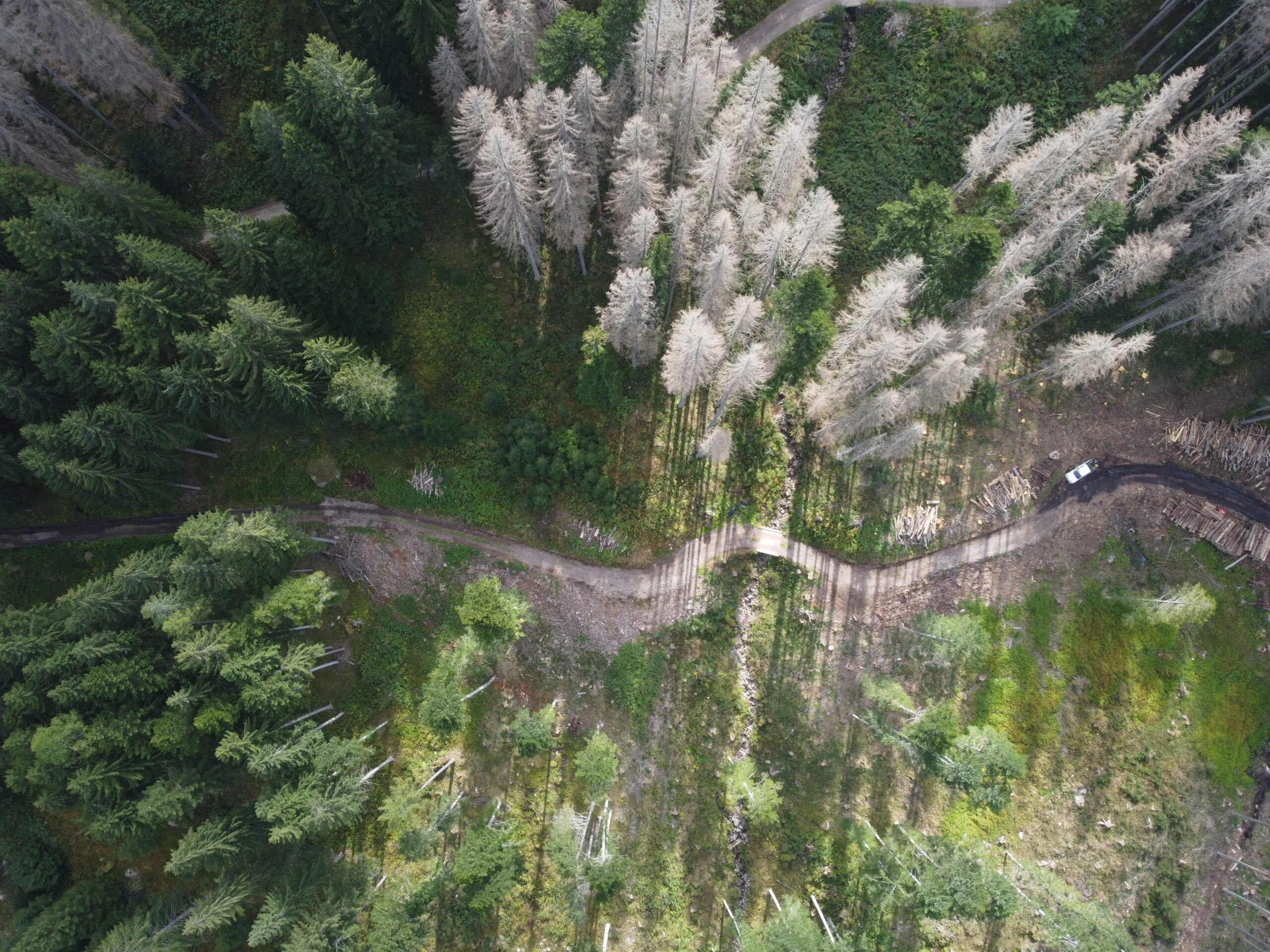
Drone photos by Duccio Rocchini and Michele Torresani.
As part of the EarthBridge project, we have the opportunity to capture photos using drones. Here are some of the most beautiful ones as an example.
-
EarthBridge Scientists Featured in GEO BON Newsletter
In the December edition of the GEO BON newsletter, which highlights global efforts in biodiversity observation and monitoring, several publications authored by scientists involved in the EarthBridge project were featured. Specifically, three research articles led by Vít Moudrý and others were mentioned, focusing on key challenges in biodiversity modelling and the accuracy of spatial environmental…
-
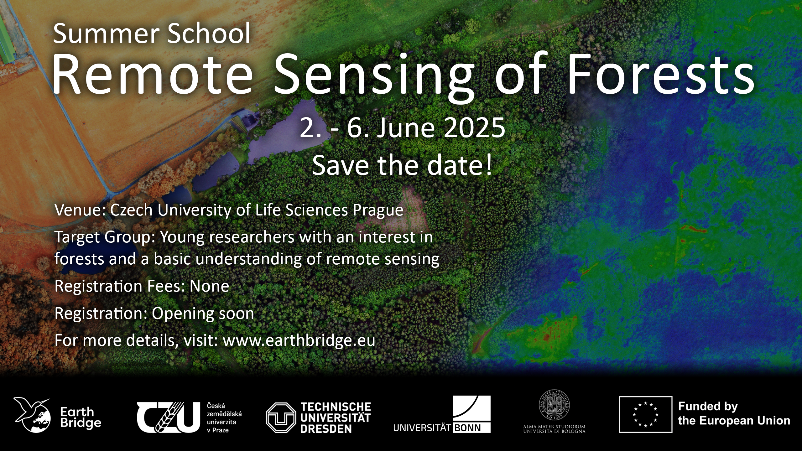
Summer School 2025
-
Successful PhD Defense of Kateřina Gdulová! 🎓
The defended thesis presents innovative research on the vertical accuracy of global digital elevation models (DEMs) with emphasis on the TanDEM-X DEM as the latest addition to the global DEMs. It is based on three scientific papers: Study 1 – TanDEM-X DEM Accuracy: Published in Remote Sensing of Environment—the leading journal in the field—this study…
-
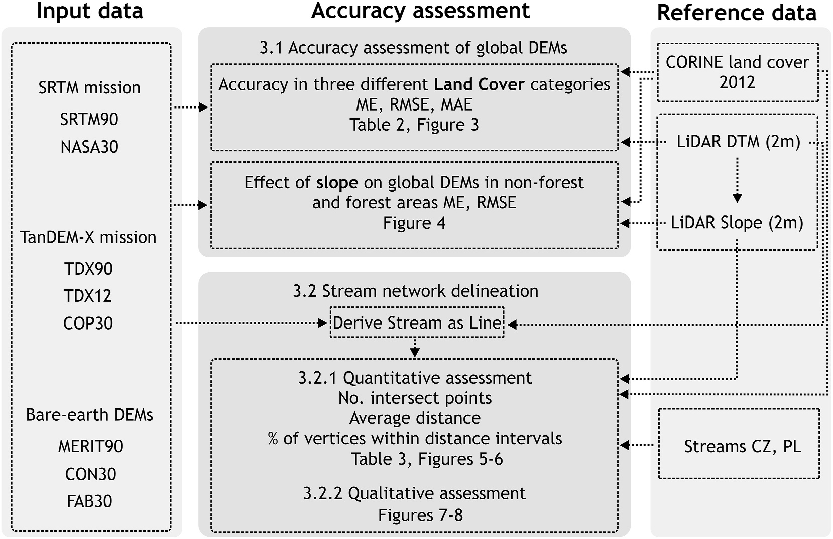
Members of the EarthBridge team collaborated on a new article.
Choosing the Optimal Global Digital Elevation Model forStream Network Delineation: Beyond Vertical Accuracy The Importance of Digital Elevation Models (DEMs)Global digital elevation models (DEMs) are vital for various hydrological applications, including stream network delineation and flood modeling. However, their accuracy often suffers from vegetation and building offsets, making bare-earth DEMs a promising alternative. This study…
-

Jan Komárek from the EarthBridge Team Joins the Evaluation of Biodiversa+ Projects
We are delighted to announce that a member of our team, Jan Komárek, has been selected as an evaluator of project proposals within the prestigious Biodiversa+ program. This program focuses on biodiversity research, and its 4th call, titled „Biodiversity and Transformative Change“ (BiodivTransform), represents an ambitious initiative supporting innovative projects aimed at nature conservation and…
-
Addressing multiple facets of bias and uncertainty in continental scale biodiversity databases
A new article by Elisa Marchetto and her team addresses the growing issue of biases and uncertainties in large-scale biodiversity databases, which are essential for biodiversity research and conservation on a continental scale. Expansion of Biodiversity Databases and Their Limitations The growth of biodiversity databases, such as BIEN and sPlot, presents crucial opportunities for research…