
Author: Lucie Moudrá
As coal mining sites across Europe are gradually retired, a unique opportunity is emerging to return these landscapes to nature. But how do we know if restoration efforts are truly successful? Our new study highlights how airborne remote sensing, specifically lidar and hyperspectral data, can help monitor ecological restoration by capturing habitat heterogeneity – a key driver of biodiversity.
This interdisciplinary study brought together remote sensing experts and ecologists from the Faculty of Environmental Sciences, combining technological innovation with ecological insight to better understand the characteristics of post-mining habitats and their role in supporting biodiversity. The study focused on the Radovesická spoil heap, a former lignite overburden deposit, and its surrounding area in northern Bohemia. The site includes three distinct types of reclamation: agricultural, forestry, and areas left to spontaneous succession. The surroundings of the restored area consist of agricultural fields and mixed forests. Using remote sensing data and field bird surveys, we explored how different habitat features influenced bird communities.
What we did:
Birds were chosen because they respond strongly to habitat structure and are commonly used as indicators of ecosystem health and proxy for overall biodiversity. We examined overall species richness and also categorized birds into “guilds” based on their nesting, foraging, or dietary preferences. In total, 83 bird species were recorded across 231 sampling points.
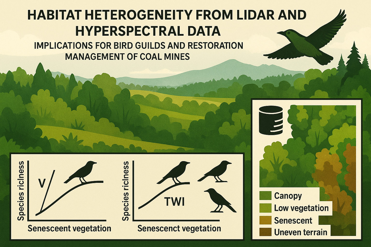
In our analysis, we focused on vegetation structure, terrain character, and reclamation status (reclaimed/unreclaimed area). For vegetation, we considered the amount of old (senescent vegetation), standard deviation of vegetation height and two layers of vegetation cover (understory, canopy). Terrain was described using curvature and topographic wetness index. Finally, we accounted for whether the area was part of a restored site or an undisturbed surrounding landscape.
What we found:
The results showed that vegetation structure and senescence were the most important predictors of bird richness. Areas with varied vegetation height and senescent vegetation supported more diverse bird communities. Terrain characteristics had weaker but still detectable effects, particularly for ground-nesting species. Importantly, these relationships held true both within the restored spoil heap and in the surrounding agricultural and forested landscapes. This suggests that the remote sensing variables used are robust indicators of habitat quality across different land-use types.
Why it matters – from data to decision-making
One key takeaway is the ecological value of early successional habitats in the process of natural regeneration. The study highlights their role in supporting birds that are declining elsewhere. Beyond the academic insights, this work has practical implications. As EU countries develop national plans under the new Nature Restoration Law, cost-effective monitoring tools will be crucial. Remote sensing offers a scalable, repeatable way to assess habitat conditions across large areas, supplementing ground-based biodiversity surveys. With remote sensing, we can move from occasional site checks to systematic, landscape-scale monitoring that supports data-driven conservation.
For more details please see: https://doi.org/10.1111/1365-2664.70071
