
Author: Juan Alberto Molina Valero
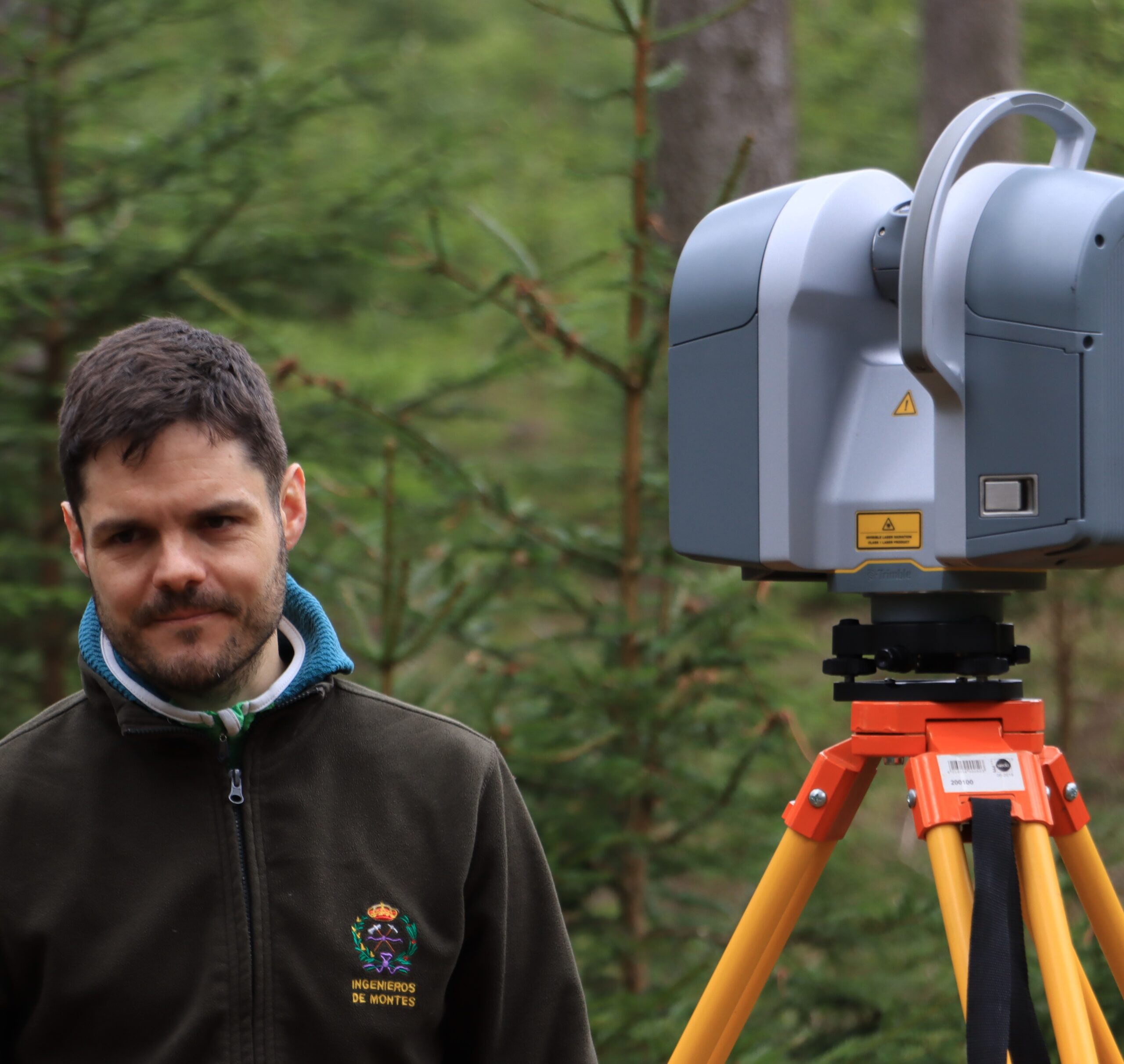
These days, with drones and satellites capturing stunning views from above, it’s easy to forget that some of the most powerful tools for understanding our forests are still on the ground. In our recent study, we explored how a ground-based laser scanning tool—called terrestrial laser scanner (TLS)—can help us measure forests more accurately and efficiently. We carried out this research in pine forests in Galicia (northwest Spain), testing how different technologies and data analysis methods could give us better information about the amount of wood in a forest, while saving time and effort.
Why does this matter?
Forest inventories are critical for sustainable management, carbon accounting, and biodiversity monitoring. Traditional field-based surveys are accurate but labor-intensive and expensive, especially when scaling up. Remote sensing technologies offer a way to extend coverage and automate data collection, but the challenge lies in finding the best
combinations of tools and methods that deliver both accuracy and efficiency.
What we tested
We tested four different ways of estimating how much wood is in a forest, using both traditional fieldwork and modern technology. These methods ranged from simple techniques based on manual measurements to more advanced approaches that mix field data with laser scanning tools on the ground and from the air.
To break it down:
- Simple method – Just used basic field measurements or ground laser scans.
- Field + ground laser – Combined field data with extra information from ground-based laser scans.
- Field + drone laser – Used drone-based laser scans along with field plots.
- All-in-one method – Mixed field data, ground laser, and drone laser to get the most complete picture.
We tested all these methods in a 16-hectare forest. For each method, we ran 10,000 different test scenarios by selecting different samples. It allowed us to see how accurate and reliable they were on average, and to understand which approach gave the best results with the least amount of effort.
Key findings in plain language
- Ground-based laser scanning (TLS) works pretty well, but not perfectly on its own. When we used it by itself, it often underestimated the amount of wood in the forest—unless we applied some corrections to account for things like hidden trees or obstacles.
- Mixing TLS with traditional fieldwork gave much better results. When we combined ground laser data with field measurements, the estimates were much more accurate and had fewer errors.
- Laser scans from drones are very useful—but only if we also have enough field data. The drone-based method only performed better than traditional approaches when we had enough ground plots to support the calculations (at least covering about 7% of the area).
- The best results came from combining everything: field plots, ground laser, and drone laser. This all-in-one approach gave us the most accurate and consistent estimates—even when we had fewer field plots to start with.
So what’s the big deal?
Our study is one of the first to take a close look at how ground-based laser scanning can be used not just to measure trees, but also to support smarter forest data analysis. We found that even simple, single-position laser scans on the ground can be surprisingly effective—especially when combined with fieldwork and drone-based data. While drones often steal the spotlight in modern forest mapping, our results show that using both ground and aerial tools together can give the most accurate and practical results, especially for real-world forest management.
Behind the scenes
This project was a collaborative effort between researchers in Spain, the Czech Republic, and Germany. Fieldwork took place in Galicia’s radiata and maritime pine forests. We were especially grateful for the help of several dedicated field assistants and colleagues who helped manage data collection and processing.
Looking ahead
The tools and methods tested in this study can be applied to other forest types and regions, but further testing is needed—especially in more complex or heterogeneous environments. We’re also hopeful that with more accessible software and affordable LiDAR devices, these methods can become part of standard operational practices for forest agencies and land managers.