
Rubrika: Blog
-
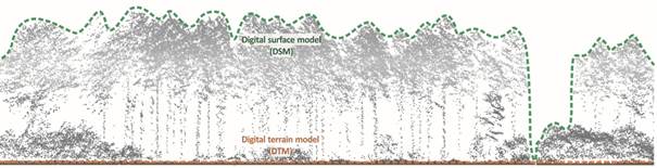
Is TanDEM-X a DTM or DSM?
Author: Kateřina Gdulová Global radar-based Digital Elevation Models (DEMs), such as TanDEM-X and SRTM, are widely used to represent different aspects of the Earth’s surface. However, one key question often goes unaddressed: Are these DEMs digital terrain models (DTMs) or digital surface models (DSMs)? These models are used as both DTMs and DSMs, sometimes without…
-
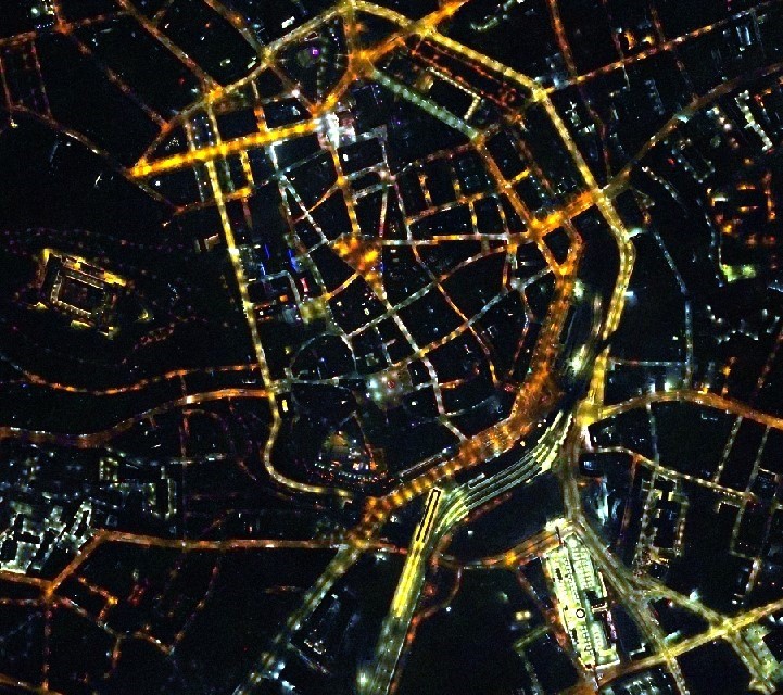
Darkness as an Endangered Species: Why Light Pollution Matters
Author: Tomáš Klouček Darkness, once an integral part of life on Earth, is now rapidly vanishing. The spread of artificial lighting—often excessive, misdirected, or poorly regulated—has created a form of pollution that is both overlooked and far-reaching. Known as light pollution, it disrupts ecosystems, affects human health, and fundamentally alters our relationship with the night…
-
Early Research Mobility Experiences: My Visit Exchange to Bonn
Author: Michal Kučera To make the most of my PhD journey, I sought early experience through a short research exchange at the University of Bonn. I wanted to immerse myself in a concentrated research environment, which I believed would help me refine my research concept and uncover connections with other scholars’ work. By engaging with…
-
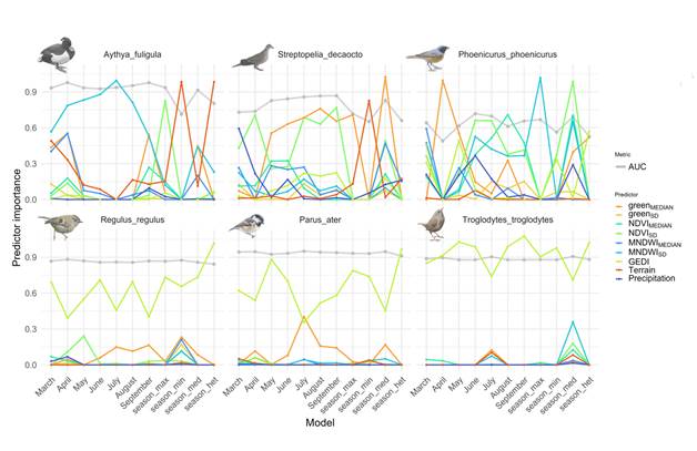
Why Timing Matters: How seasonal changes shape bird species distribution models
Author: Dominika Prajzlerová Species Distribution Models (SDMs) are powerful tools that help scientists understand where species live—and why—by linking species occurrences to environmental conditions. These models often use remote sensing (RS) data from satellites to describe habitat conditions across large areas. But one key question often goes overlooked: When is the best time to acquire…
-

Tracking the Hidden Climate Impact of Invasive Plants
Author: Giorgi Kozhoridze A joint research initiative between the Czech University of Life Sciences in Prague and Tel Aviv University aimed to explore a frequently neglected impact of invasive plant species: their capacity to alter the local climate. Concentrating on the delicate coastal sand dunes of the eastern Mediterranean, the research investigated how two invasive…
-
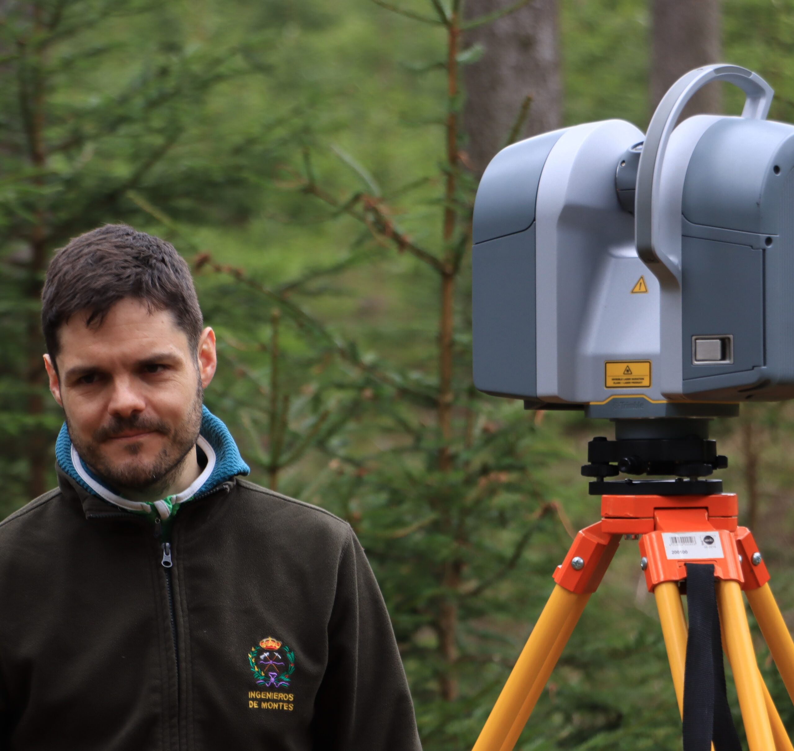
How Ground-Based LiDAR Is Transforming Forest Inventories
Author: Juan Alberto Molina Valero These days, with drones and satellites capturing stunning views from above, it’s easy to forget that some of the most powerful tools for understanding our forests are still on the ground. In our recent study, we explored how a ground-based laser scanning tool—called terrestrial laser scanner (TLS)—can help us measure…
-
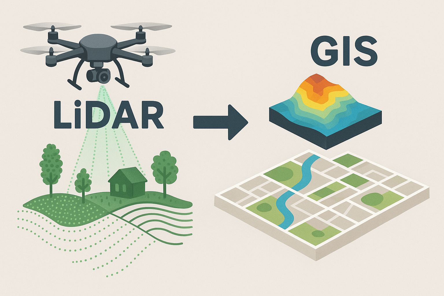
Lidar in Students‘ Final Theses
Author: Vitezslav Moudry Recent months have been marked by the completion and evaluation of student theses. It should come as no surprise that the students I have supervised have often worked with laser altimetry data in some way and that these theses are closely related to what we are doing in EarthBridge. Two studies validated…
-
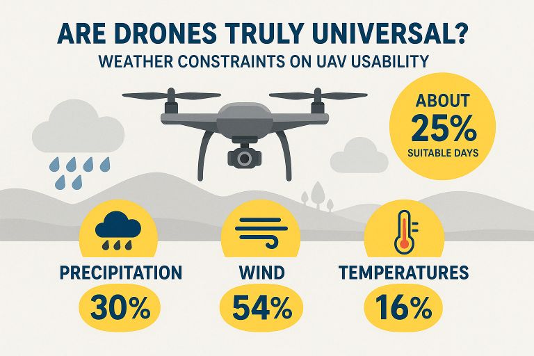
When Wind Blows
Author: Jan Komárek Drones have revolutionised environmental monitoring, promising on-demand, high-resolution data collection in places satellites can’t reach. But beneath the hype lies a harsher reality: weather. I analysed meteorological records from 31 Czech locations (2016–2024) and found that drones are actually grounded about 75 % of the time. Here’s why—and what we can do…
-
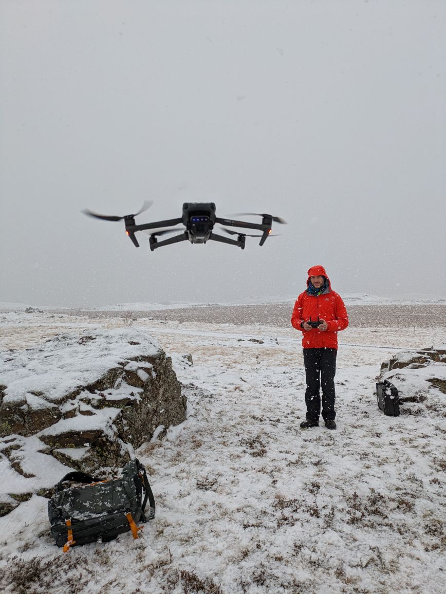
Experience from the Polar Winter School – Remote Sensing in Arctic Conditions
Author: Jan Komárek From March 2nd to 8th, 2025, we had the opportunity to participate in the 2nd Polar Winter School in Hvanneyri, Iceland, organized by the Czech University of Life Sciences Prague in collaboration with Landbúnaðarháskóli Íslands and the Nordic Snow Network. The event brought together students and experts from 14 countries, focusing on…
-
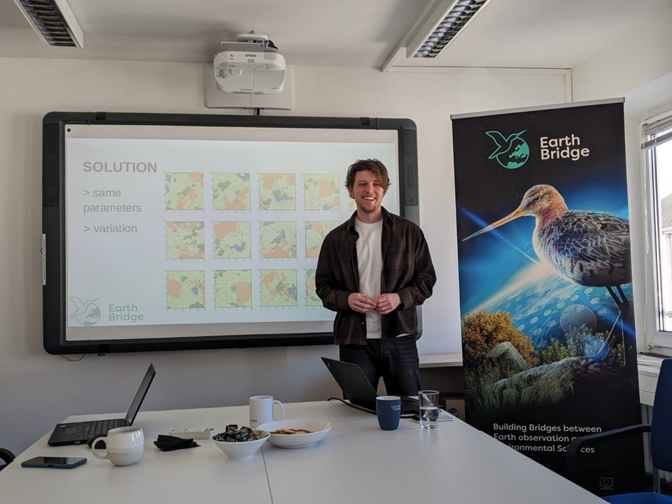
Spectral Characterization of Bird Habitats: Research Exchange at the University of Bonn
Author: Richard Bittman As part of the „Building Bridges between Earth Observation and Environmental Sciences“ project, I recently completed a research exchange at the University of Bonn with Prof. Anna Cord’s team. This collaboration strengthened my doctoral research on avian habitat characterization using remote sensing techniques. With Prof. Anna Cord Research Focus My work addresses…